Day 1: Biking: 15miles, +5000ft elevation, Skis: 11miles, +4300ft
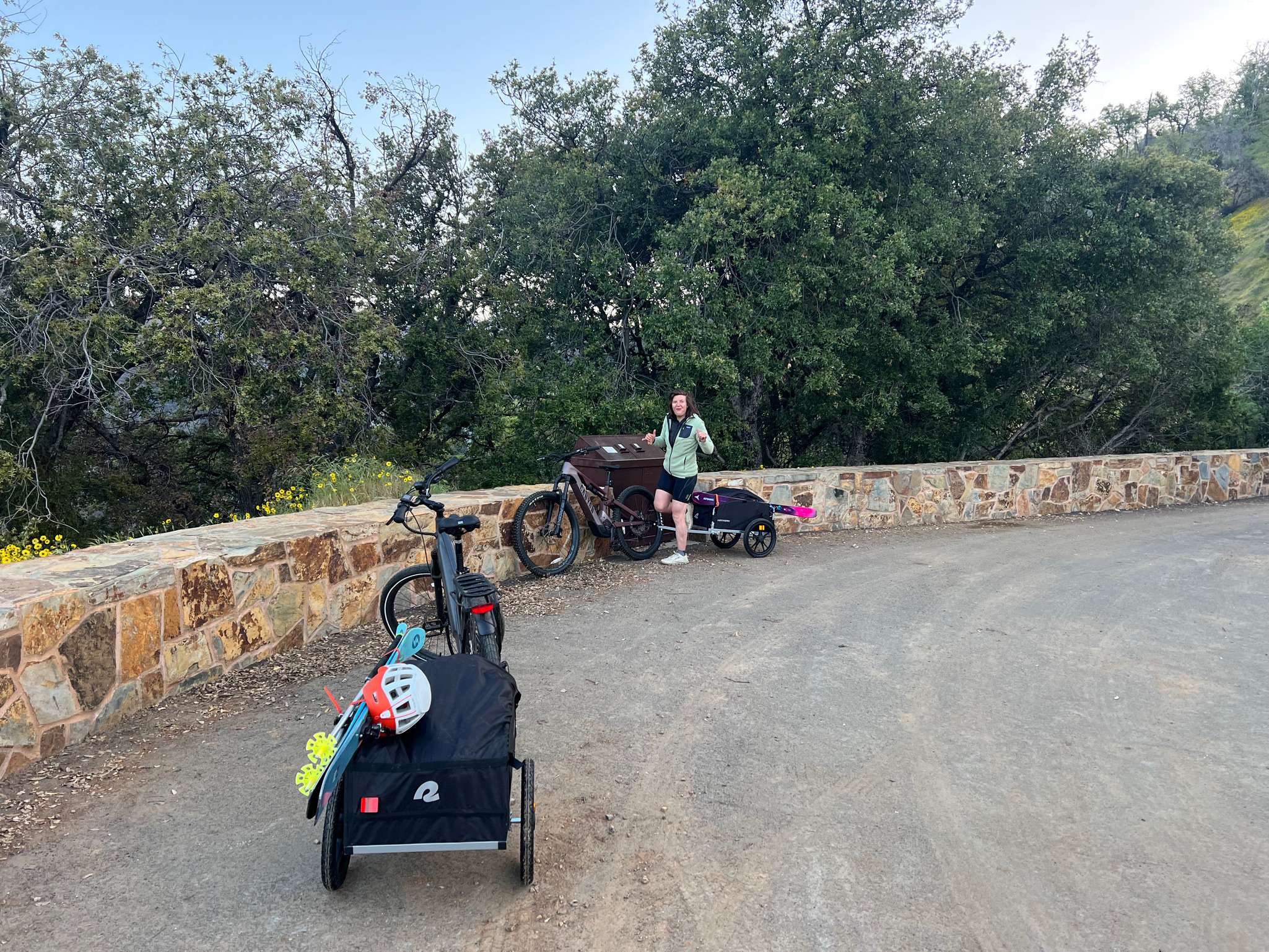
Sarah and I had finally set out on the high sierra route, a trip that had been years in the making. We’d hoped to do it the prior couple years, but between covid and low snow, the stars never aligned. With a monstrous snow year and lack of employment 2023 seemed like the year. Logistics seemed like the crux of the route, despite only being 50 miles apart driving trailhead to trailhead would take 6 hours, meaning a car shuttle would take 12 hours extra hours of driving. Shuttles were not really an option, and chartering a flight seemed extravagant. Lucky for us though our friends Kyle and Jazmine were planning a trip east to west along the same route. A key-swap was in store, they live just few minutes down the road from us, so exchanging cars back in town wouldn’t be an issue.
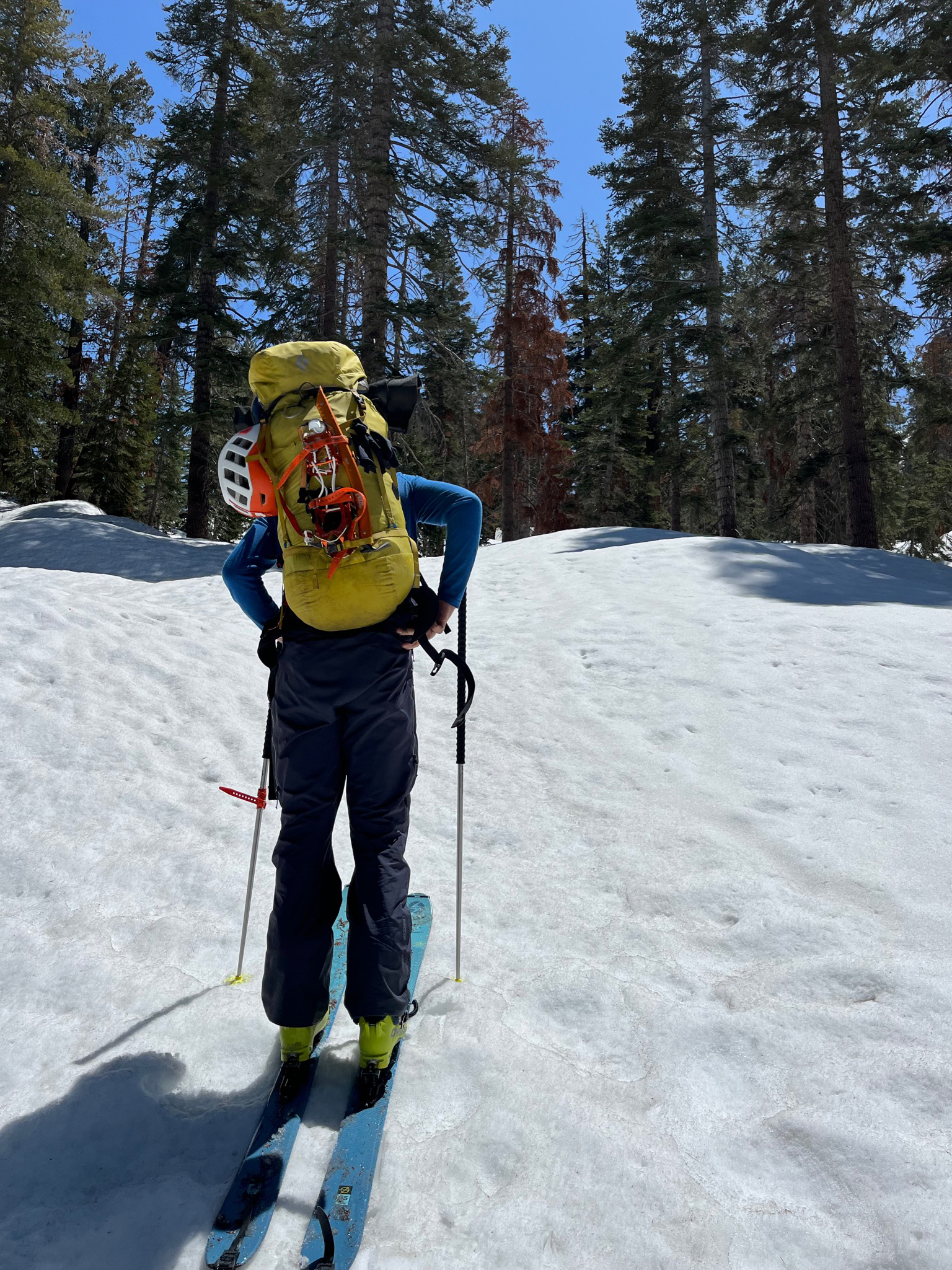
Next up was the issue of the western trailhead being closed. The winter’s storms had washed out the windy road that lead from the foothills up to 7000ft at Wolverton. Sequoia national park was giving some helpful updates, however it seemed that the road was not going to be open in time for our departure. We really didn’t want to walk the 15 miles and 5000ft of elevation gain that was closed. A helpful ranger told us that if were to bike on the road before 7am no one would be the wiser. Getting to Wolverton before 7am seemed reasonable, especially with the aid of an e-bike and trailer. Included in the keyswap was the bike lock keys so Kyle and Jaz could coast down the hill after they arrived at Wolverton.
Finally, on our e-bikes going up the hill we ascended from the oak chaparral into the giant sequoias, and finally to the snow. We were able to transition from bikes to skinning immediately. Happy to not need to carry our skis on a our back we skinned out of the dense forest (the snow at the beginning was more pine-needle than snow). The skinning was quite uneventful until we neared the pear lake hut, at which point it had become so sloppy that our skins barely held onto our skis, Glob Stopper be damned.

Up until this point we hadn’t seen any one at all save for some cars returning down the “closed road” which was essentially damage free except for two spots where they already had traffic lights controlling the traffic in the one lane sections. We came across a lone skier, who we had thought was just coming down from the pear lake hut. I had tried to say hi and chat but he seemed to be in a rush, for good reason I later learned.
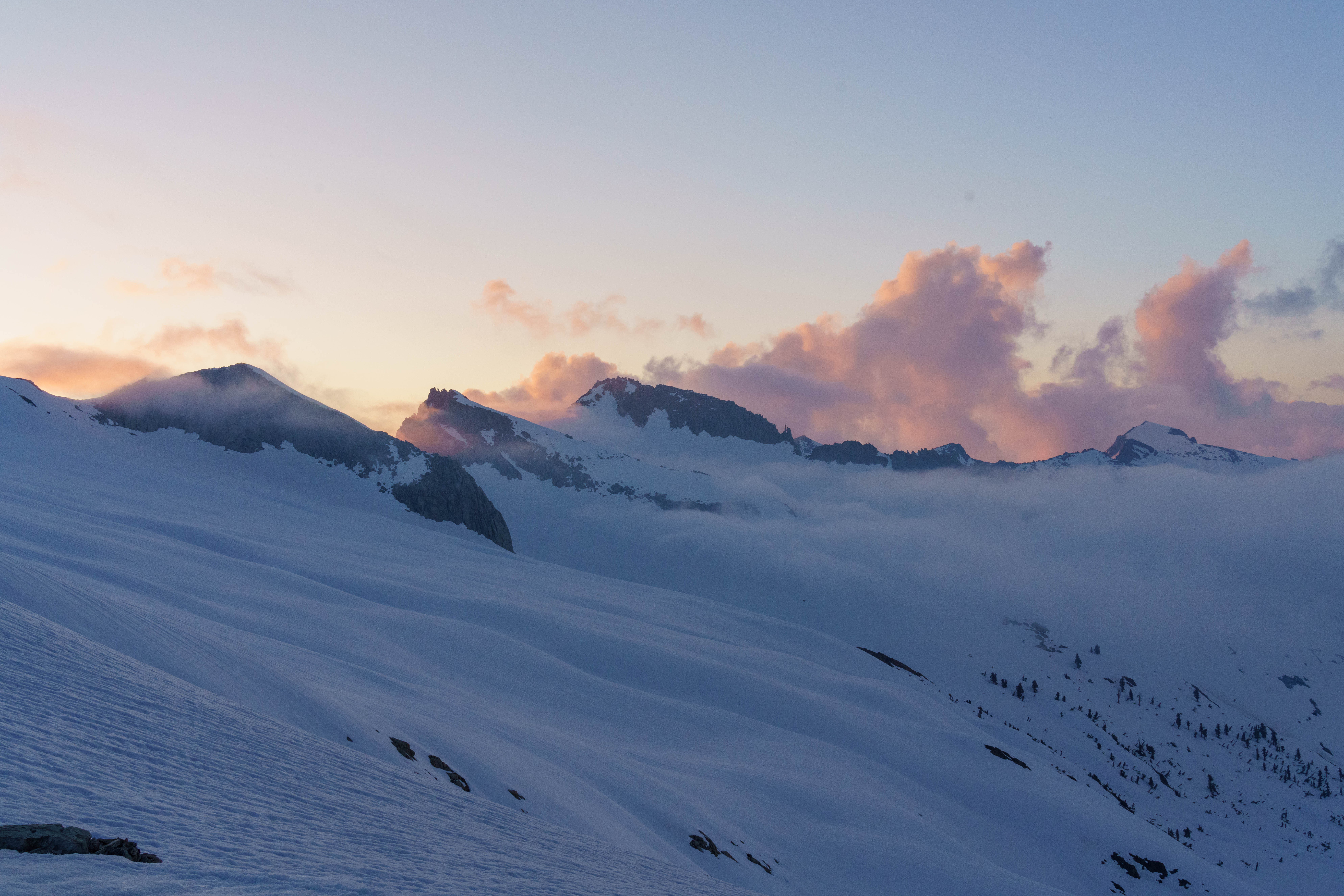
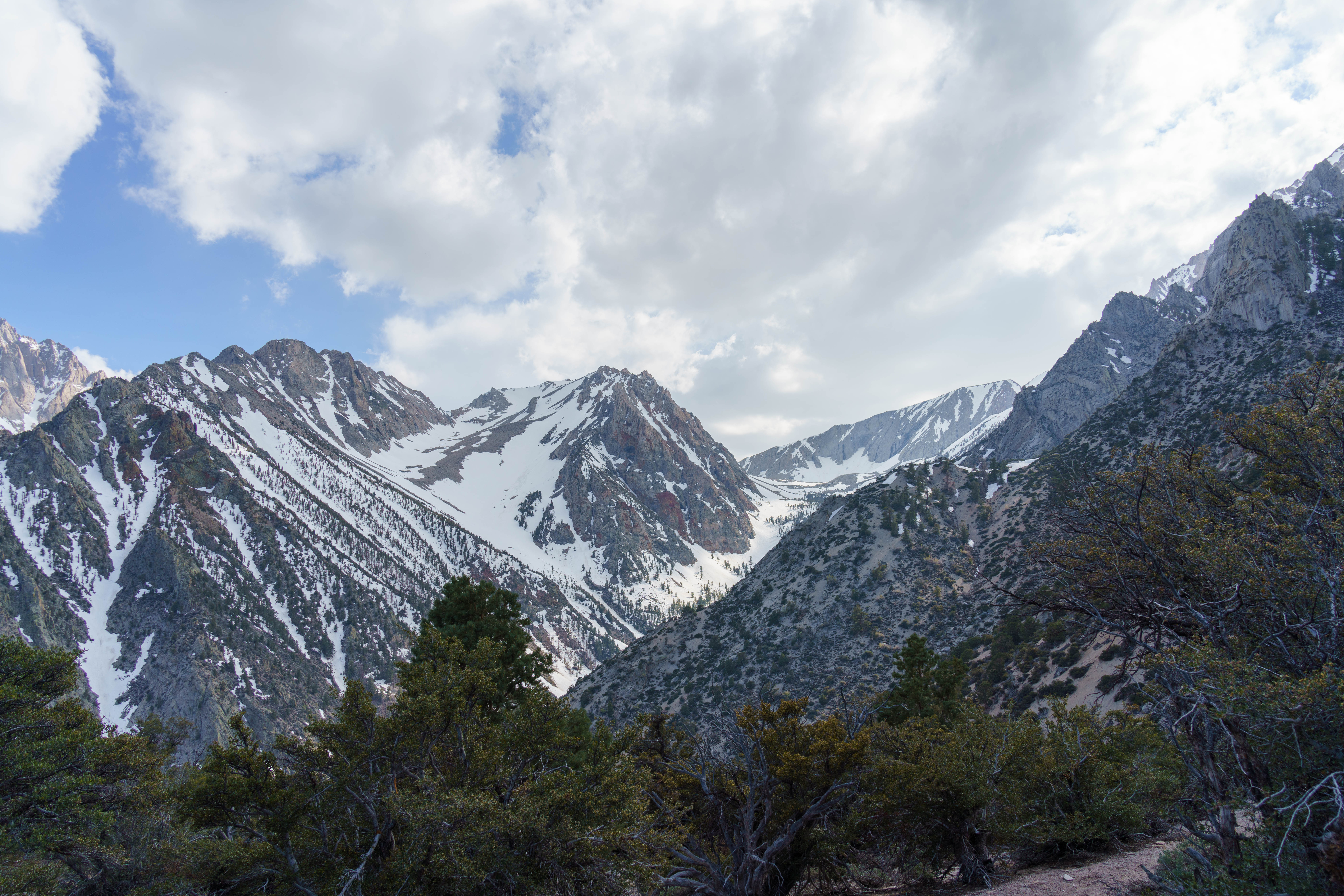
Many hours of side-hilling later we came to the tablelands where were planned to camp for the night. This was at the headwaters of the marble fork of the Kaweah river. We found a nice flat spot in a stand of pine trees. We could hear lots of water but couldn’t see any. Not wanting to spend an hour melting fuel, we found a fissure in the snow and went fishing for water.
Day 2: 9.5 miles, +2970 feet

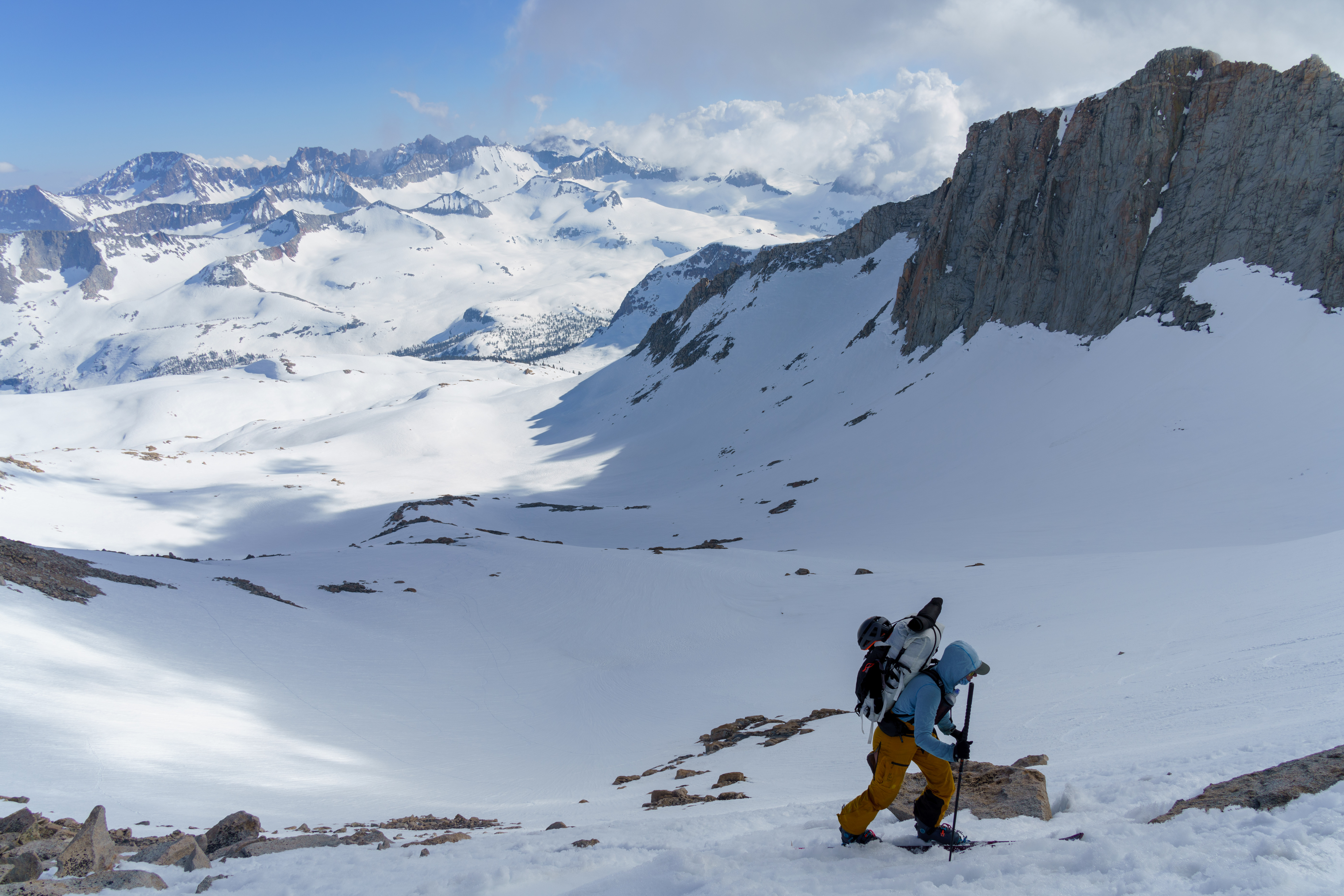
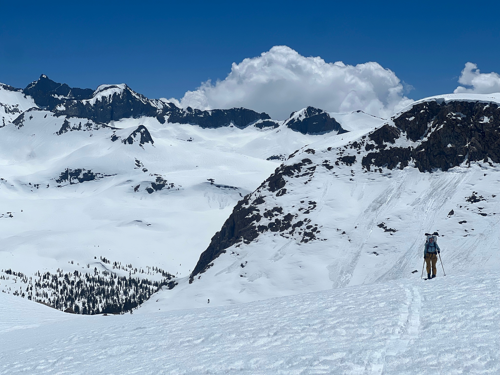
The next morning we headed for pterodactyl pass. This involved, what would become the primary mode of transport, side-hilling. We began to become accustom to the the dilemma between taking the direct path losing and re-gaining elevation or trying to contour around the bowl to keep the elevation but instead have to spend the whole time on edges, these micro navigational choices really added up.

We had hoped to make it to the base of milestone pass, but looking over from the top of coppermine pass we saw across the valley to triple divide pass, said nope, ripped skins, jumped over a small bergschrund in the snow, on a skied over a mile without taking a single turn to find our next camp overlooking cloud canyon. This campsite was perhaps the best of the whole trip. It had it all, running water, protection from the wind, and stellar views. We made dinner as the sun set and then went to bed.
Day 3: 12.7 miles, +3360 feet
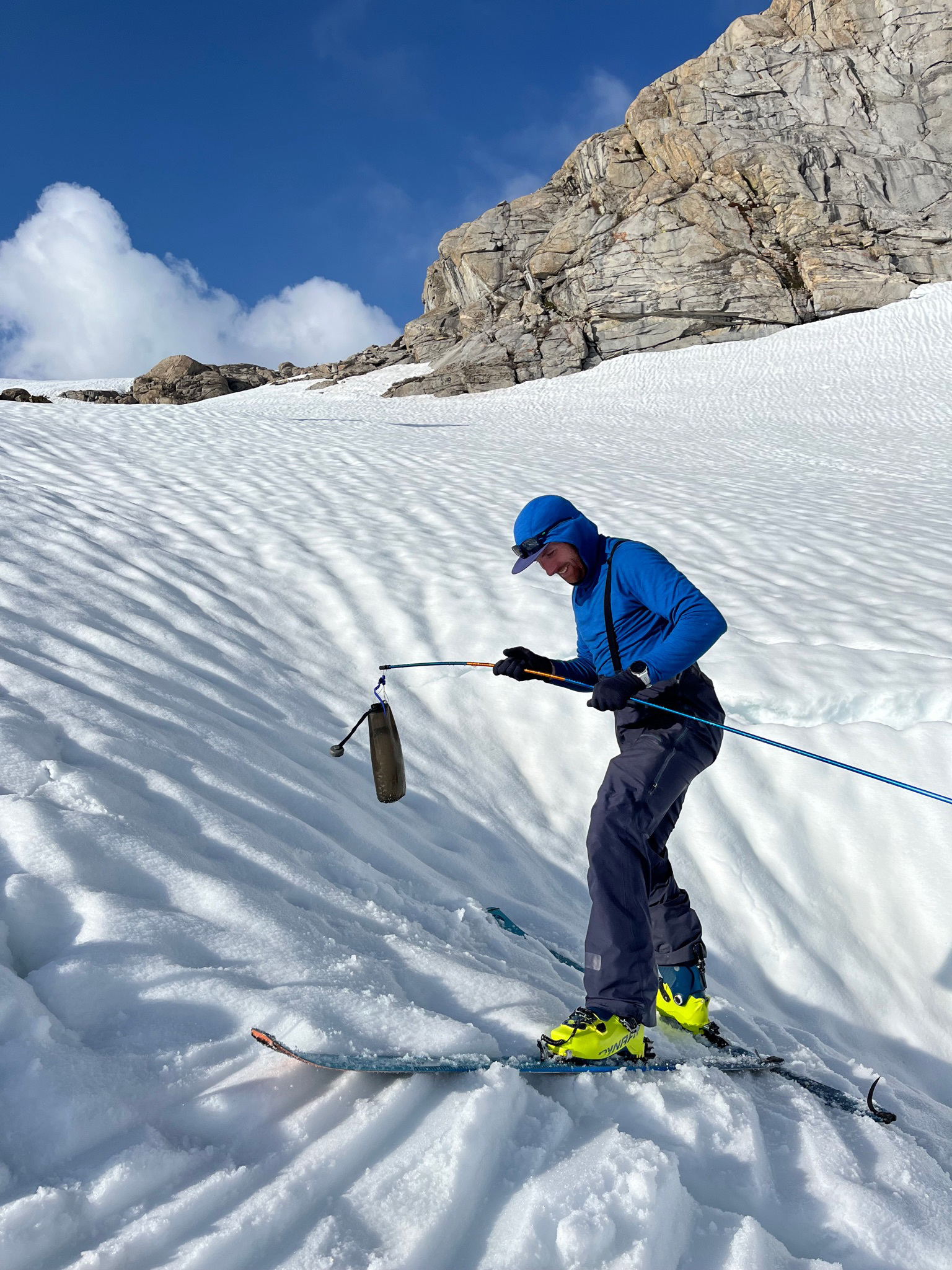
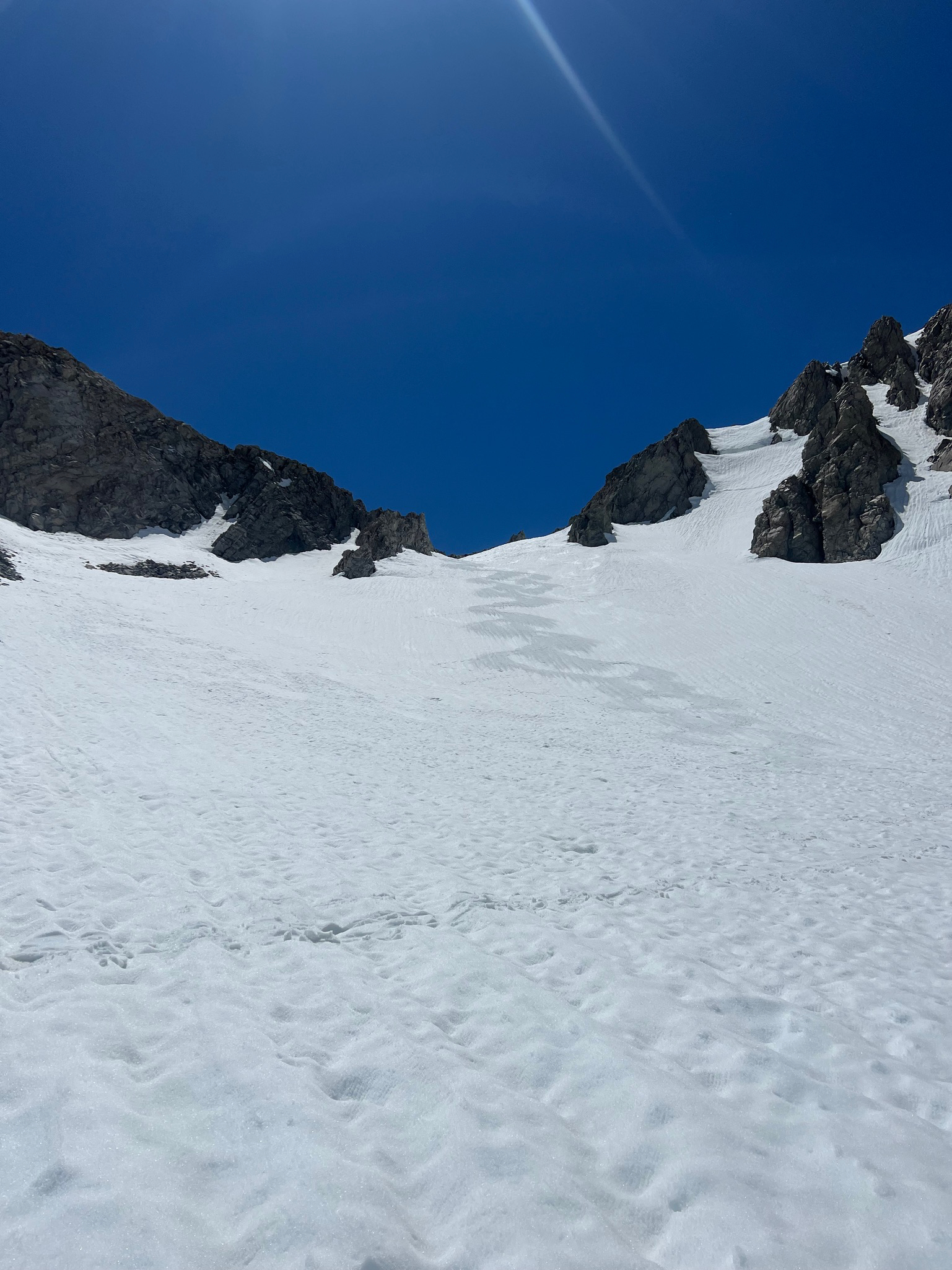
The next morning we started skinning up triple divide pass which was still quite firm and needed ski crampons. After making it to the top of Triple Divide pass, we had a quick snack and then started looking for Kyle, Jaz, and the rest of their party for lunch. We had meant to camp together at the western base of milestone pass, but sidehilling made the seemingly few miles drag on. None the less we had a great time swapping beta for spots with running water, the steepness of the passes, and sharing some food. It was pretty awesome to see our friends many miles from any sign of civilization. However we couldn’t hang out forever and had to keep moving since we still had another pass to climb up, milestone pass. This is the high point on the typical high sierra route, just at 13,000 feet. This was quite the slog, despite the temperatures only being in the 40s, it felt like 100 degrees due to the intense solar oven that we were in. We were going through sunscreen like no tomorrow even though only our faces were uncovered. At a certain point I was getting so sunbaked, that I took my fleece and draped it over my hat for further sun protection.
This was a pretty rough day, we were behind, and feeling a bit demoralized. We had carried a few days of extra food to perhaps do an extension on the trip, heading north near Mount Stanford for some extra descents. After falling a bit behind on the main trip we decided that trying to do any extra skiing wasn’t worth it. The sun cups made travel really difficult, and sucked most of the joy of the descents. Given this we decided to just stick with the main path.
Finally at the top we could see pretty far to the northeast and down to our next campsite along the Kern river. The pass it self was pretty cool as there were fins of rock akin to Matthes crest on either side of the pass.

We didn’t want to spend too much time at the top though as the steep east side of the pass was in the shade and the snow was quickly refreezing. After a few steep turns, we glided almost all the way down to the north fork of the kern river. Despite being less than 4 miles from the head waters it was already quite a roaring river and finding a spot to cross seemed difficult. We setup camp on the west side of the river and made some dinner.
Day 4: 7.6 miles, +2300ft
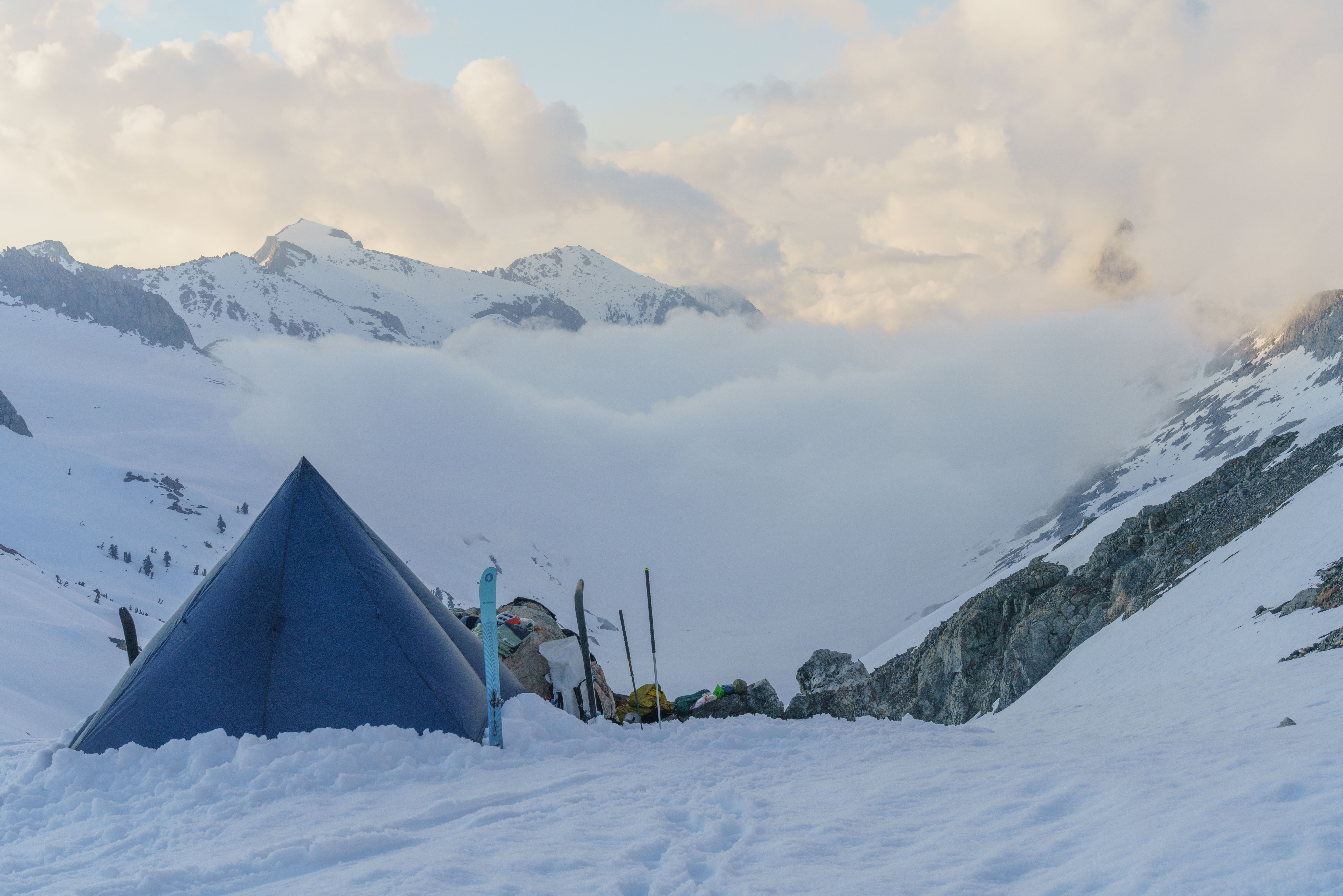
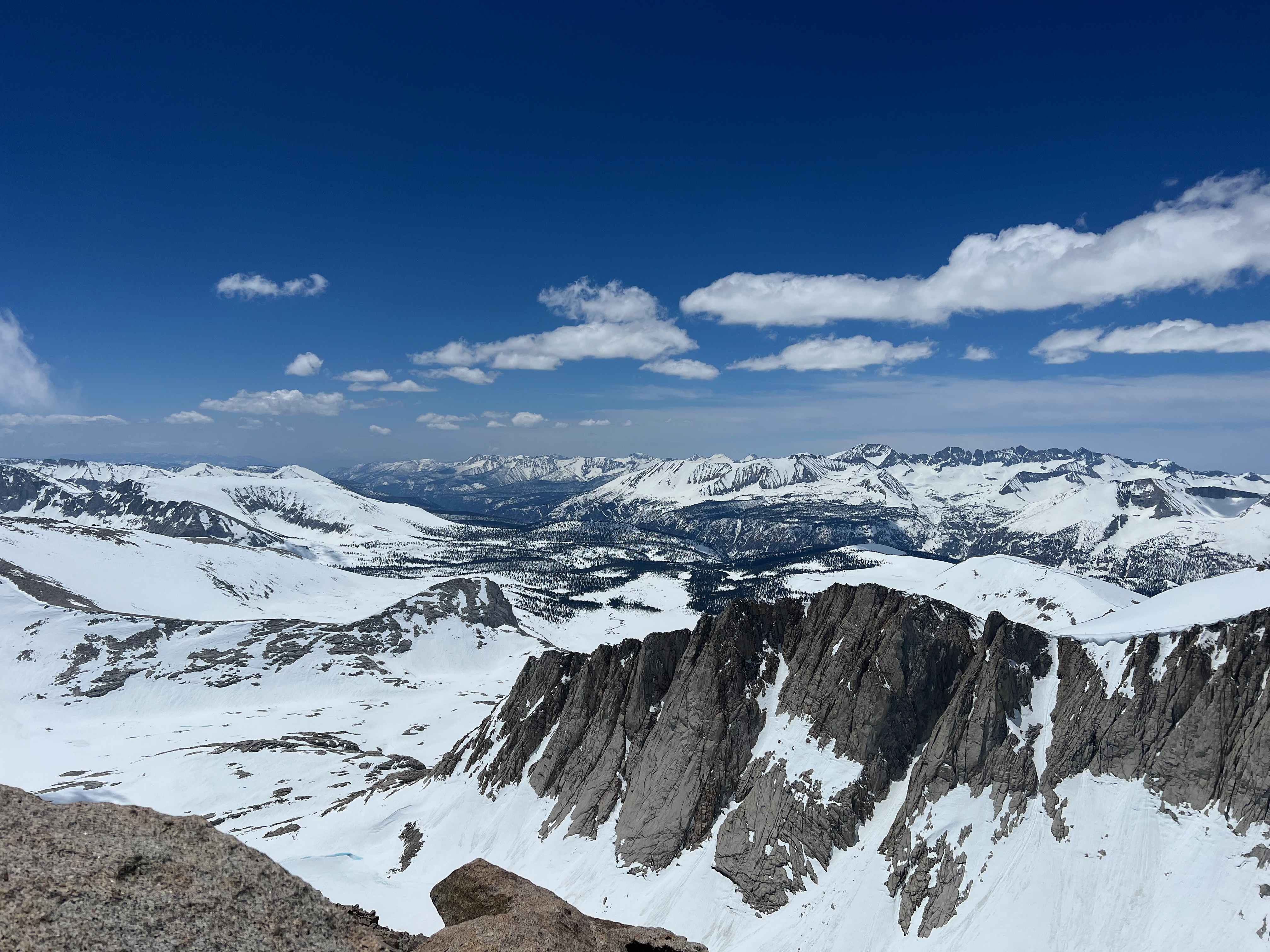
This day was pretty uneventful as it was mostly a gradual uphill rather undulating terrain with many passes to climb. The only real highpoint was a small buttress on the south side of Mount Senior. This nondescript little hill had a surprisingly good view. We could see Mount Whitney to the south and Mount Tyndall to the east. After this we made our way towards the Tyndall plateau. While skinning along Tyndall Creek we saw some PCT hikers in the distance heading north. Seemed absolutely miserable to be postholing through the wet snow, but given that it was already the end of may they didn’t have much other choice if they wanted to finish the trail. That evening we camped on dry ground for the first time on the trip and it was so much warmer despite being the highest campsite at just about 12,000 feet. It was quite windy in the afternoon so spend an hour building a rock wall around the tent, but in the evening the breeze died down and we got a great night sleep.

Day 5: +3000ft, 16 miles
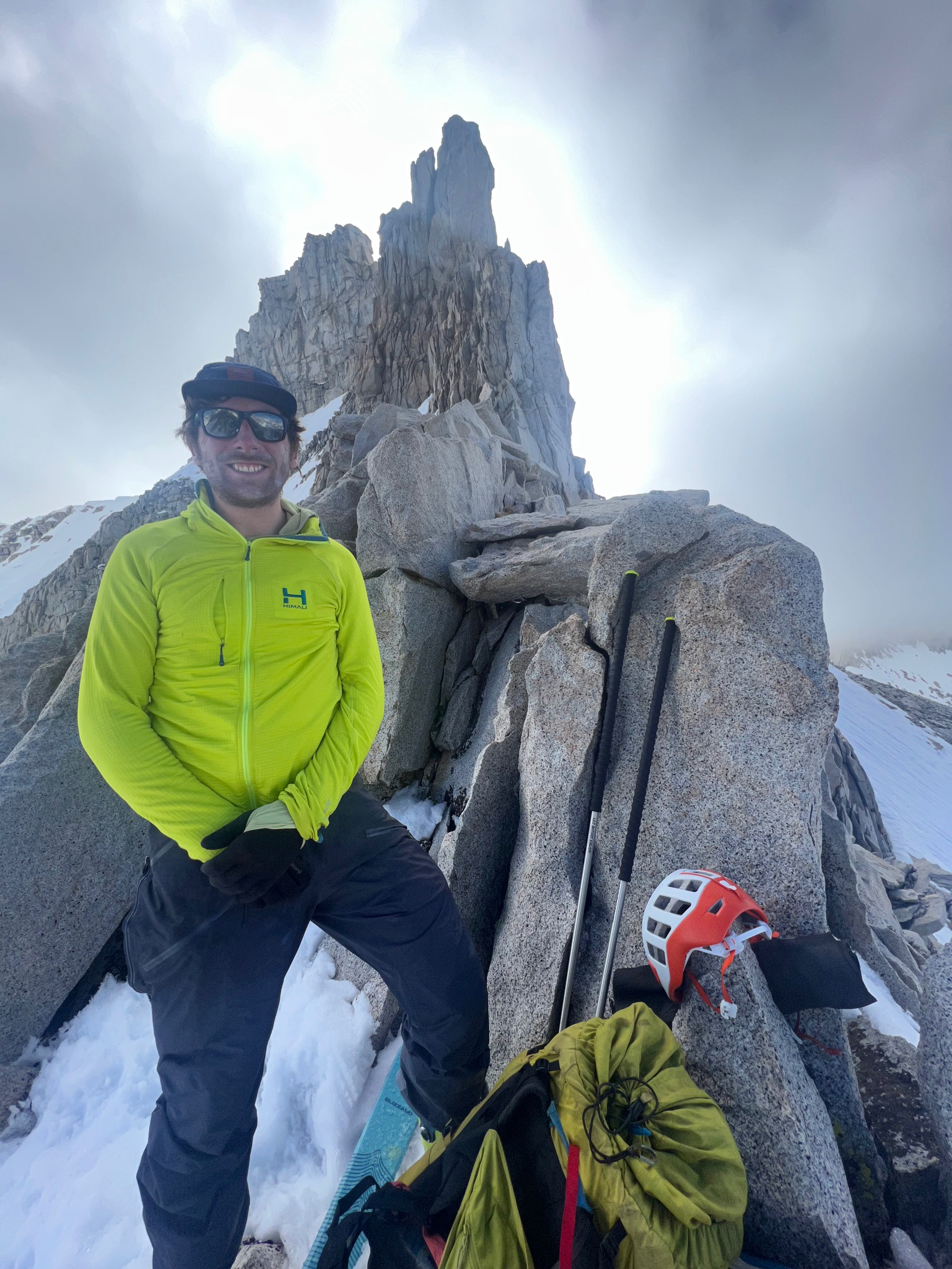
Today we planned to take our only deviation off of the main route, climbing and skiing Mount Tyndall. Skiing a 14er seemed like worthy diversion, and we were hoping that it would have some decent snow. Given its northenly aspect and high elevation it was hopeful. We started climbing, and got to about 13k feet, but the snow wasn’t softening up. Cramponing up the snow wasn’t great, so I decided go continue up the rocky ridge and Sarah decided to ski down from there. The ridge was better than expectd, quite solid, and reasonable 3rd class. After a while on the ridge, I decided to move back to the snow just below the ridge in order to avoid some of the steeper rock above. Eventually I made it to a little col and dropped my skis and made a 1/4 mile ridge scramble to the summit and took in some views. Descending the northeast face of Mount Tyndall was really nice, it was probably some of the best skiing on the trip above 13k. Smooth and not suncupped like everything else.
Sarah and I met back up at the top of Sheperds pass. This was the end of the traverse, just a few miles down the canyon and we’d be back at the car. We were mostly able to ski all the way down to 9500 feet.
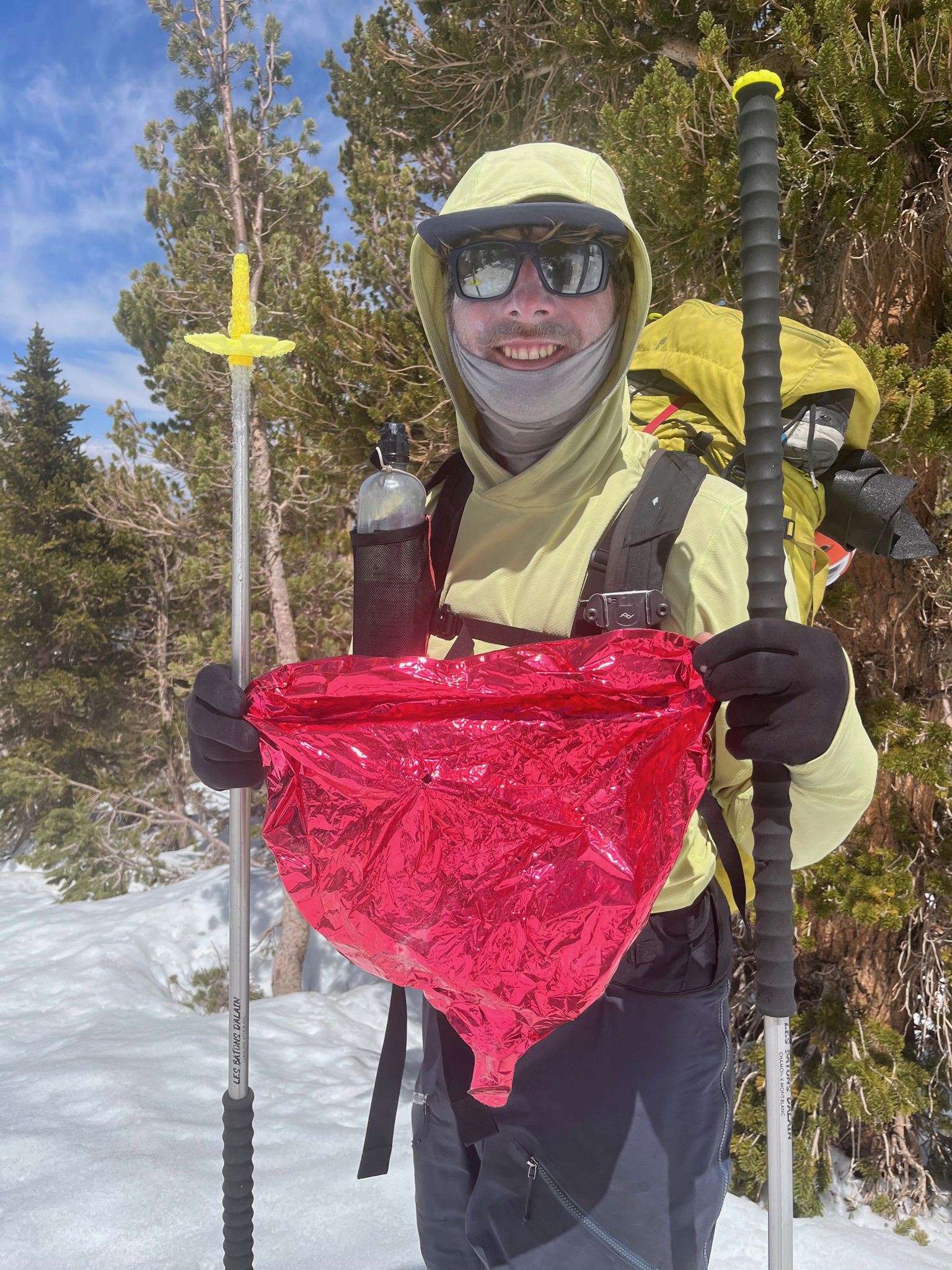
This wasn’t easy as we hoped, it was quite desperate to connect the various ribbons of snow, but we made it work. On the way down we happened to find 3 different mylar balloons that had somehow gotten trapped in the drainage. In the 7 months since this trip, I’ve since found lots of balloons in the backcountry, but never had before this trip, funny how that happens. After getting off the snow we started hiking down the Sheperds pass trail, after 5 days in on the snow and wearing ski boots it was nice to be finally wearing the trail runners we had lugged across the sierra. Save for that rocky ridge on Mount Tyndall, travel at this point had only been on snow and 99% on skins. The trail was actually pretty nice for hiking, only a bit sandy in spots. The trail doesn’t go all the way down Shepherds creek as the walls are far too rocky, so it diverts over Symmes Saddle down to Symmes Creek. This was the worst part of the trail as it was covered in patchy refrozen snow which made travel quite difficult, but we soon made it back onto dry ground. I was pretty gassed at this point as we had been moving for a while.
It was about 7pm and we made it to the last crux of the route, all the creek crossings. We had talked to our friends who had done the creek crossings a few days ago, they seemed pretty nonplused about them, so we weren’t worried. They were crossing at the best time of the day and we were crossing at the worst time. We deliberated between camping another night and waiting until the morning or just fording the creeks. I really wanted some warm food and a beer so we went for it. The trail crossed the river 3 times, so once we did one we were pretty committed. The first crossing was probably the deepest, most of the way up my thighs. While I was crossing I dislodged a couple rocks and the current threw what seemed like soccer-ball sized boulders quite far. By far the strongest creek I’ve crossed. We made one route finding mistake and ending up having to cross two extra times for a total of five.

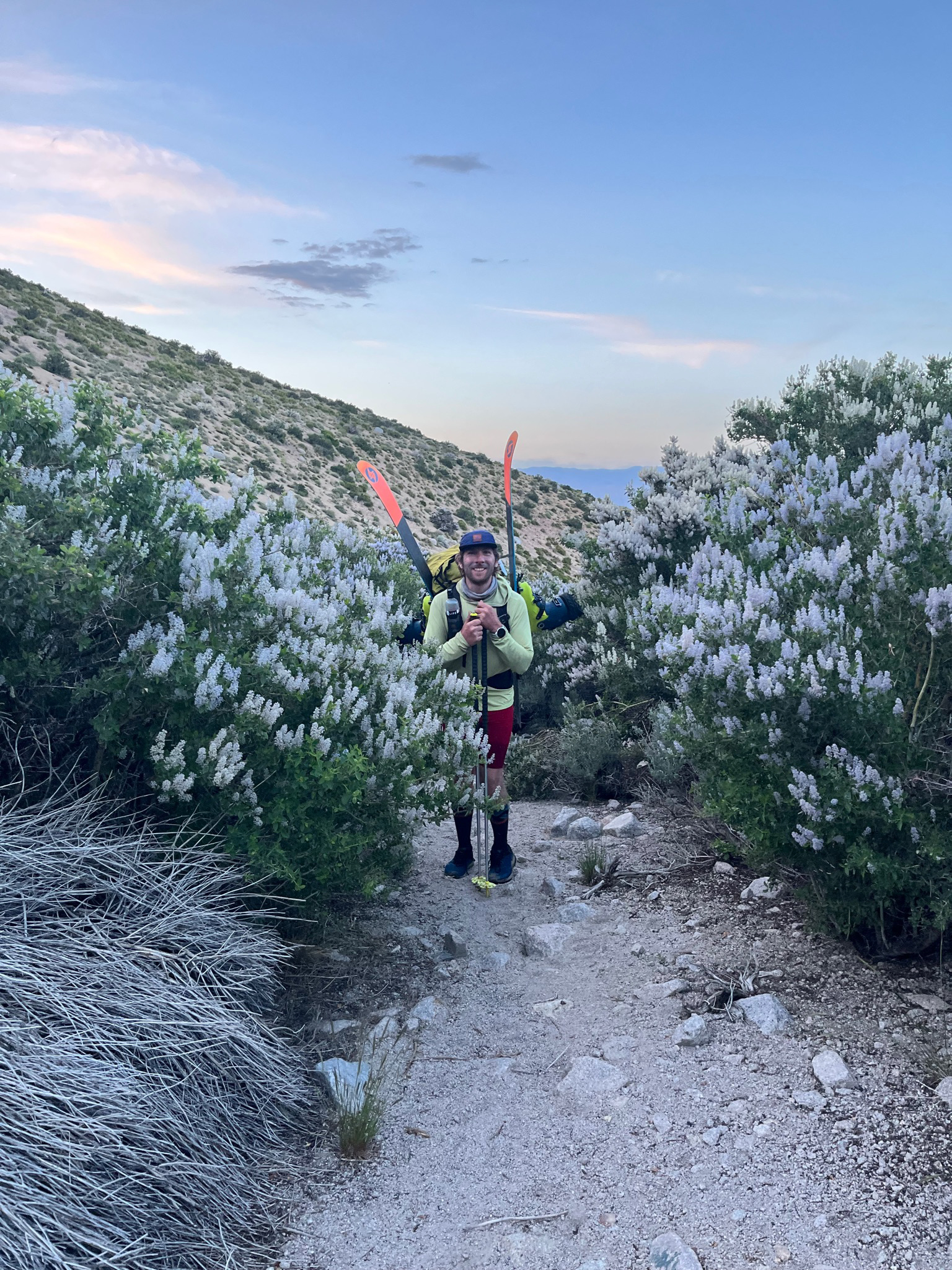
Once we were done with the last crossing we started to see some signs of civilization, we knew were close. Once away from the creek we wondered into a grove of trees in full bloom with very flagrant flowers. I never figured out their name but it was such a surreal experience to be walking through that with the ombre sky above us.
Another half mile and were at Kyle and Jaz’s car, we put on some clean clothes and sped off to bishop for the closest motel. It was 9pm and we didn’t want to drive all the way back to South Lake Tahoe. Sadly the only thing open in bishop was Carl’s Jr, but it tasted pretty dang good, if only they also served beer. Laying in bed that night catching up on what’s been going for the last week, I spotted a post on snow brains that the FKT for the High Sierra Route had just been set (obviously not by us), but by that person we ran into on the first day. He went east to west on the same route in just 17 hours and 18 minutes and on Telemark gear none the less!
This was one of the coolest adventures I’ve ever been on. It was so immersive being so deep into the sierra and linking the western and eastern sierra into one trip. This will be a trip that I’ll never forget. Despite the boiling temps and human-sized suncups it just made want to spend more time in the range of light.