Jackie and I had planned a week of climbs in the Canadian Rockies. Among the various objectives we discussed, the Northwest Ridge of Mount Sir Donald in Glacier National Park stood out as the one we both wanted to climb the most. Originally, we intended to climb it over two days by bivying at the base. However, the plan became complicated due to summer rains. It was raining the evening before our scheduled climb, making it uncertain whether we could stick to our initial bivy plan. The idea of bringing a tent and additional rain gear as part of the bivy made the situation less appealing. Opting for a one-day climb seemed preferable, especially considering the 4000ft approach and the burden of carrying lots of gear. Consequently, we decided to find a spot in the campground at the trailhead near the top of Roger’s Pass. This site offered a welcome change from the typical camping I was accustomed to since leaving the Bugaboos the week before. The campground had amenities such as bathrooms, running water, and a picnic tables— far superior to a nondescript pullout.
We cooked some dinner, packed our bags with the gear and food for the next days climb, and set the alarms for 2:30 AM. As we fell asleep it briefly rained which complicated things. We figured that even if it rained during the night the warm temps and dry mountain air would dry the rock quite quickly.
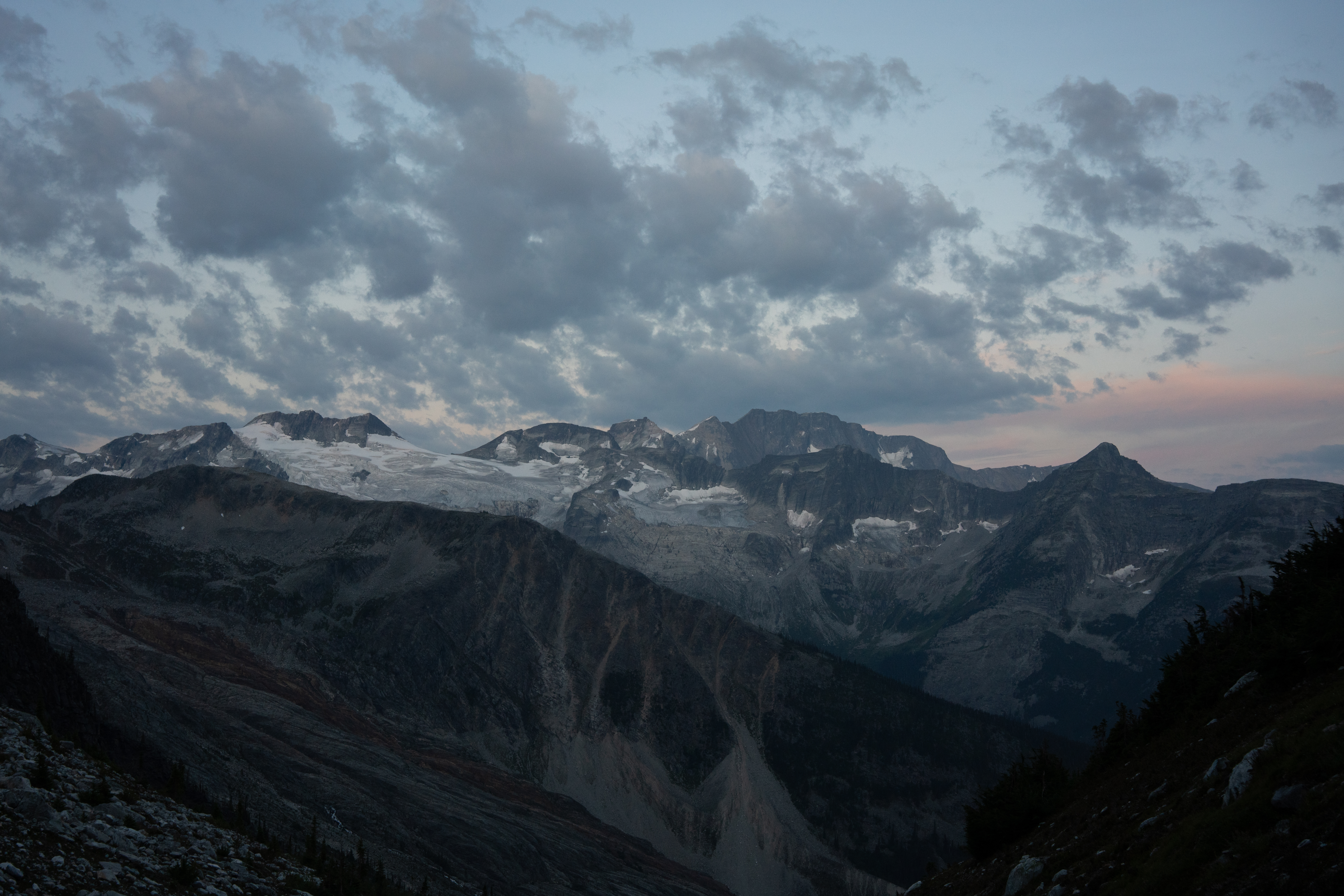
Once the alarms rang we drove to the trailhead, made some ramen, and set off into the forest. Walking through the dense forest at 2:30am was quite warm and humid, not something I was used to doing alpine starts in the sierra, where its always cool and dry in the night on all but the warmest of days. The hike went pretty quickly in the dark. Once we hit the lower bivy, about 3000ft above the trailhead, the sky started to get light and we saw a beautiful sunrise and got our first glimpse of the giant cirque we were in. We dropped our trekking poles and bear spray at the bivy and kept going.

After another 1000ft of talus and scree hopping we made it onto the ridge where the climb starts. It immediately reminded me of climbing the north ridge of Tricouni peak near Squamish the summer before. I took the first lead, which ended up being a 500 ft simul pitch. On this pitch we were passed by a soloist. As he passed he seemed to be really struggling and unsure of the route finding. It also kind of disturbed me that he was wearing running shoes that looked like something you’d get at Big 5 and not something that would offer much confidence when climbing. Soon enough and he was out of sight and I didn’t have to spend much time worrying about him.
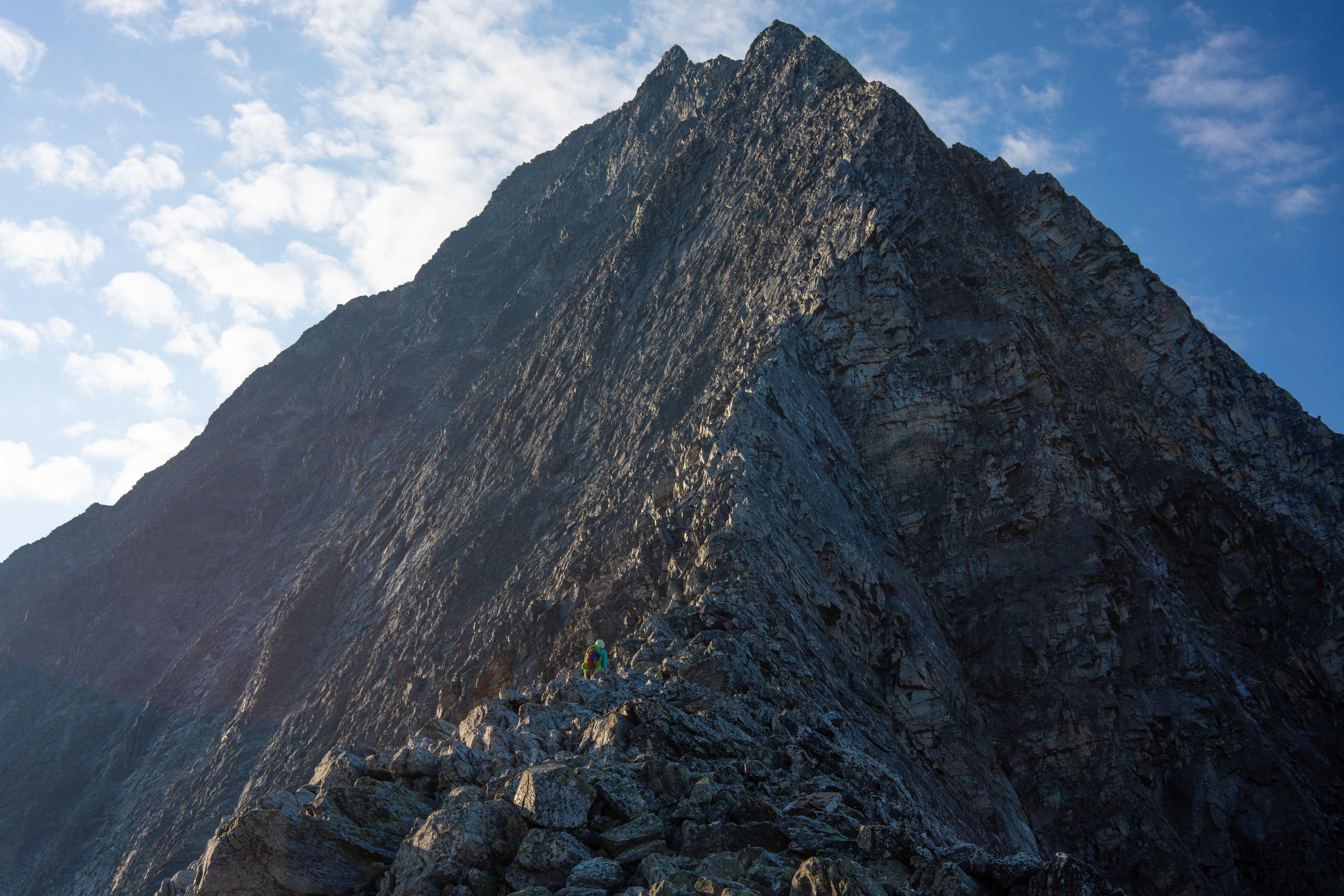
After about 5 simul pitches we came to a second class section where we could confidently unrope for a bit as the exposure had abated. This spot was where the west-face bypass descent route rejoined the ridge on the way down. After the second class ridge there was about 3 more simul pitches of climbing to the summit, which seemed to drag on forever as the summit looked so close. Finally we made it to the summit at about 1:30 pm, we still had maybe 7.5 hours of daylight so we felt pretty good about getting back to the car before dark. Little did we know how treacherous the descent would be. After some snacks we deliberated about how to get down. There were two options, either down-climb the whole ridge or take the west face bypass to avoid the steepest parts of the ridge. We decided that the west face bypass might be a better choice as it would be a bit quicker not having to down simul. While its true that a rope was not needed it wasn’t an easy to descent as we had to pick our way down cliff bands and be very sure-footed on the abundant loose scree. We made it back to the ridge and started looking for the rappel anchors as noted in the beta. The descent on the ridge proved pretty heinous in its own way. There were about 12 rappels interspersed with unknown lengths of down-climbing. The descent took much longer than the climb up as we had to look for anchors and switch back and forth between rappelling and down-climbing many times. About half way through ridge descent we got the rope stuck on a diagonal rappel. I had to climb back up and free the rope. Luckily we didn’t need to cut it free even though it really felt like we would for a while. This was a little sketchy since I didn’t have enough rope to lead back up the anchor. Once I climbed up a little bit I fixed the rope to a piece and tied catastrophe knots to myself to keep moving up without risking a deadly fall.
One or two more rappels on the ridge and we started doing the more straight-forward rappels on the lower west face back down to the talus field and the bivy site. Finally on solid ground again around we ate some food, drank some water, and thought about how much the steep descent trail was going to hurt our knees. After another quick rest at the bivy spot we started down the trail, it was about 9pm at this point and we had 4 miles to go. The hike out was pretty uneventful and we got back to the car at 11pm meaning we this was a 20 hour day with 6500ft of elevation gain and loss. Too tired for dinner we fell asleep in the same campground. The next day we woke up late and made a great breakfast of bacon and eggs before heading to a lake for a nice swim and visit with some otters.


